Background
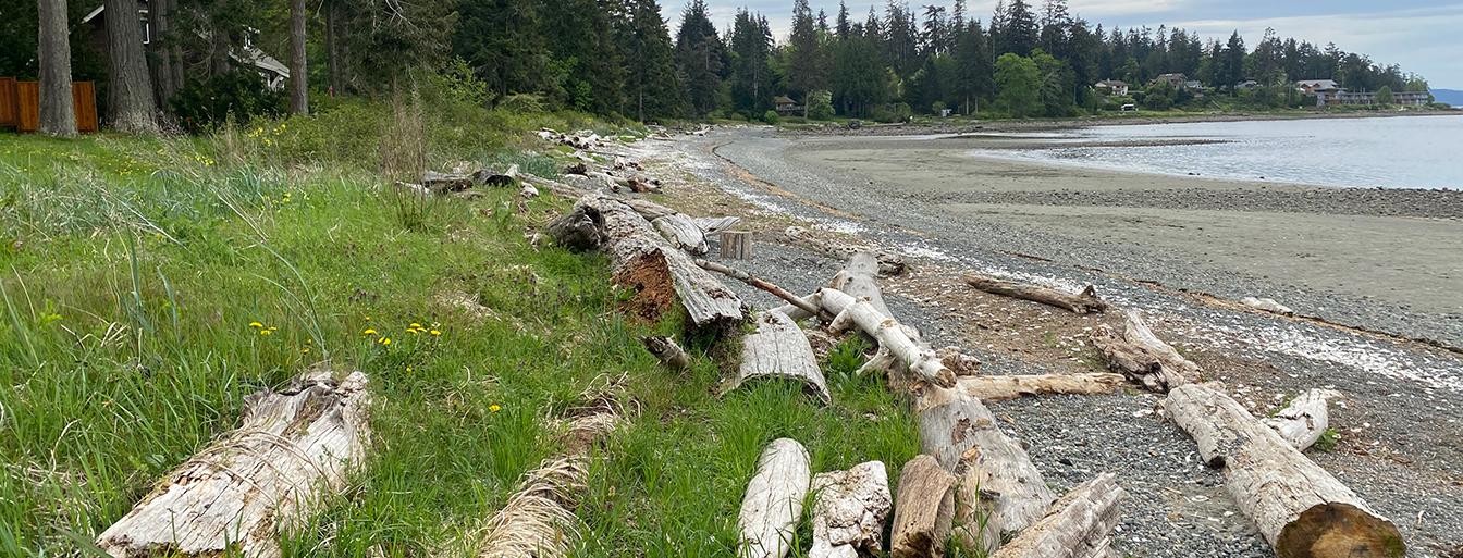
In coastal areas of the Comox Valley Regional District (CVRD), sea levels are expected to rise as a result of climate change, which will increase flooding from coastal storms. Planning for these changes now will help reduce costs and impacts in the future. In 2018, the Province directed Local Governments to plan for 1 metre of sea level rise. To address this and other climate-related coastal flood issues, the CVRD is developing a Coastal Flood Adaptation Strategy (CFAS).
Project goals include:
- Minimize risks and vulnerabilities and increase community resiliency from climate change impacts.
- Build adaptive capacity to respond effectively to climate change impacts over time.
- Increase awareness and education among CVRD staff, external parties and the community to enhance coastal adaptation and flood risk understanding and capacity.
- Strengthen the relationship between the CVRD and external stakeholders.
- Develop preferred adaptation options for managing coastal flood resiliency and mitigating coastal flood hazards.
- Prioritize coastal flood adaptation efforts.
The CVRD has taken a multi-phased approach in developing the strategy. Regulatory Coastal Floodplain Mapping from Phase 1 is available.
Phase 1
-
A necessary first step in coastal flood management is to acquire coastal flood hazard maps to better understand where and how deep the water might be in a flood event. Phase 1 of the strategy involved detailed analysis and modelling of coastal flood hazards, including various combinations of coastal storm and sea level rise scenarios. With funding support from the National Disaster Mitigation Program, this work was conducted by Kerr Wood Leidal (KWL) Associates Ltd. A variety of mapping products were created, and the project was completed spring 2021.
Phase 1 Findings
The Coastal Flood Mapping Project is now complete. The Coastal Flood Mapping Final Report provides an overview of the mapping project including the scope, methodology, high level key findings and recommendations for next steps.
-
- Appendix A - Technical Memorandum #1 – Coastal and River Base Map Development
- Appendix B - Technical Memorandum #2 – Fluvial and Coastal Geomorphology
- Appendix C - Technical Memorandum #3A - Fluvial Modelling, Oyster River Hydrology and Model Assumptions
- Appendix D - Technical Memorandum #3B - Fluvial Modelling, Courtenay River Hydrology and Model Assumptions
- Appendix E - Technical Memorandum #4- Coastal Modelling
- Appendix F - Technical Memorandum # 5 - Coastal Flood and Fluvial Mapping Products
Phase 2
-
Phase 2 of the Coastal Flood Adaptation Strategy builds on the coastal flood hazard mapping results to develop and implement a decision-making process to identify preferred adaptation actions that may be used within areas of risk. Phase 2 includes a high-level risk assessment (i.e., identification of what valuable assets lie within present-day and future flood hazard areas), stakeholder engagement to understand local values related to flood risk and flood mitigation, and development of decision tools to support the identification of preferred adaptation options. The flood risk study area includes the CVRD Electoral Areas coastlines and K’ómoks First Nation IR#1, IR#2, and IR#3 (excluding City of Courtenay, Town of Comox, and Denman and Hornby Islands).
The CVRD received a $150,000 grant from the Union of British Columbia Municipalities and Emergency Management BC towards this project and retained Ebbwater Consulting Inc. and SHIFT Collaborative to conduct the work.
Phase 2 Staff Reports
-
On November 30, 2021 the CVRD hosted a virtual information session on the coastal flood risk in the Comox Valley. This presentation also provided recently updated floodplain maps for the entire area that include the effects of sea level rise and climate change.
-
Question
Response
Where can I view flood maps for this area? Coastal Flood Maps for the entire Comox Valley can be viewed here: Regulatory Coastal Floodplain Mapping. These maps show the extent of flooding for one storm scenario and include freeboard to account for uncertainty and variation in local conditions. How can we view the coastal flood mapping that shows multiple flooding scenarios? And for specific communities? You can view multiple food scenarios in Appendix E (Technical Memorandum 4 – Coastal Modelling). Why are there variations in the flood construction levels on the coastal food maps? The Coastal Flood Mapping Final Report outlines the methodology used to determine the different Flood Construction Levels. Many different factors are accounted for, e.g. beach slope, exposure to coastal storms, etc. See page 22 in the report for more detail. Where can I find out more about how the flood levels and flood construction levels were calculated? Refer to Appendix E (Technical Memorandum 4 – Coastal Modelling) for the complete explanation for how the modelling was developed to create the flood maps. The maps were produced according to established guidelines, including the BC Provincial Flood Hazard Area Land Use Management Guidelines. They can be viewed here:
Regulatory Coastal Floodplain Mapping.Did the coastal flood mapping account for local variations such as beach slope or wave energy? See Appendix E (Technical Memorandum 4 – Coastal Modelling) for more information on how the coastal modelling was developed to create the coastal flood maps. Topography, wind and wave energy are all examples of processes that were considered when the modelling was developed. Local surficial geology was considered to determine, at a high-level, the potential for erosion. Was the raising on the land related to isostatic rebound considered when developing the coastal flood maps? Yes, it was. On the B.C. coast, sea level rise has occurred in most locations but at a lower rate than the global average of 17 cm/century. Tectonic changes are a major factor on the B.C. coast, with structural uplift occurring on the west coast of Vancouver Island and subduction occurring in the Strait of Georgia. Structural uplift was accounted for in coastal flood mapping methodology. Coastal flooding is affected by both ocean water levels and river flows into the estuary. How can surges in river flows be accommodated? Technical analysis of coastal and river flood levels in the CVRD involved a combination of hydrologic and hydraulic modelling. Modelling was completed separately for coastal and river areas, while considering the interrelationship between water levels in both systems and their influence on flooding.
Phase 2 of the CFAS did not consider river flooding specifically. However, many of the adaptation strategies that were considered in Phase 2 (e.g. protect, accommodate, retreat, avoid, and resilience) also apply to adapt to river flood hazard.
The BC River Forecast Centre analyses snowpack, assesses seasonal water supply and flood risk, and monitors and forecasts flows in British Columbia’s rivers and streams through modelling. Based on available data and modelling, the Centre issues high streamflow advisories, flood watch advisories and flood warnings. Learn more on the River Forecast Centre website.
The BC Storm Surge Forecasting Program has also been developed to provide forecasts for coastal storm surge events along the south coast of BC. This has operated between October and March in recent years.
What is the Regional District doing to encourage natural based solutions in place of hard armouring shorelines? The CVRD is a part of the Green Shores Local Government Group where we participate in a peer network of learning and policy and project initiatives. Also, the CVRD encourage nature based solutions to shoreline management through OCP policy and Development Permit Guidelines. Periodically, the CVRD hosts Level 1 Green Shores Workshops for members of the community to learn more about nature based shoreline solutions. To learn more about this work see: Green Shores. Will the CVRD consider changing the RGS settlement nodes based on this new information on coastal flood risk? Yes it’s true that Saratoga Beach and Union Bay are designated as settlement nodes by the Regional Growth Strategy (RGS) and that they have also been identified as risk areas. The intent of the RGS designation was to identify the existing population in these areas, not just to accommodate future growth. Future phases of this work will focus on how we adapt and build resilience. What can we do to prepare for flood risk? There are a number of highways that will be impacted in the event of a flood? The Coastal Flood Mapping Project provides important information to build an understanding of what flood hazards look like in the CVRD under current conditions today and with future climate change. Findings show there are key areas in the CVRD that are already exposed to flooding today and are expected to become more exposed as sea levels rise. This information provides a foundation for the next phase of work to understand the consequence this flooding could have on communities, including impacts to homes, infrastructure, cultural and recreational spaces, and natural habitats. Understanding flood risk and consequences is an important next step for setting priorities for where and how to adapt and build resilience. What can property owners do to protect their homes in the absence of retreat or depopulation strategies? Property owners can stay informed in projects like this one and explore the resources available below that outline adaptation measures that homeowners can undertake to make their homes more resilient. Nature based solution like Green Shores can also be implemented to make waterfront properties more resilient. Please visit the resources below for information on how to build a home more resilient to flood. Are there local examples of homes that have built to be adaptive to flooding? Where can we see examples of this? No local examples that we are aware of but you can visit this site for ideas and inspiration on how to build a more adaptive home. Are there grants or other assistance available for property owners who want to explore and hopefully implement Building Management and other Sensitivity Reduction measures? No, not at this time. But local governments are continuing to seek grants to undertake flood risk, adaptation and mitigation works to build resilience to flood. Is the CVRD in discussions with private managed forest companies in terms of logging our watershed to avoid making the risk of rapid water runoff worse? The CVRD is involved in ongoing discussions with private managed forest companies with regard to watershed management. Please visit here for more information. My property is in the floodplain and I want to build a home. How can I determine if it’s safe to build? The CVRD has a number of land use and building regulations that guide development in the Comox Valley Electoral areas including the Official Community Plan, Zoning Bylaw, Floodplain Management Bylaw and Building Inspection Bylaw. Please contact the planning Department to discuss your project with a planner. Has there ever been consideration of creating conservation authorities in high risk coastal flood areas. For example in ON they created Conservation Authorities after Hurricane Hazel. In Canada, authority for the management of flood risk lies with individual Provinces. In BC, the governance system is mostly decentralized, and Local Governments are the primary responsible authority. This is in contrast to Ontario, where another layer of government, in the form of conservation authorities, who manage flood and erosion hazards at a watershed scale. In the Lower Mainland we saw a lot of communities using sandbagging as an emergency measure to prepare for flooding. Can this be an effective emergency method? Sandbags are the best last resort. They are however ineffective and costly in the long-term. There are many other solutions available.
Although sandbags tend to be used a lot due to their relatively low cost and immediate effectiveness, sandbags are not regarded as best practice for temporary flood protection. Sandbags lose their effectiveness during prolonged floods that cause the sand to become saturated. Following a flood, sandbags are considered contaminated (as they absorb dirty floodwater) and must be disposed of. Some steps can be taken to reduce these disadvantages (such as wrapping them in additional plastic). However, effective alternatives that are reusable and less damaging to the environment are increasingly popular, albeit at a higher cost. Examples include inflatable bladders and box barriers. See this article for more information.
-
Phase 2 is now complete. Staff brought forward the CFAS Final Report to the Electoral Area Service Committee on March 14, 2022. The Final Report provides an overview of the project, the engagement process, the structured decision-making process that was used to explore adaptation pathways and a series of prioritized implementation actions.
CFAS Final Report
- Coastal Flood Adaption Strategy Phase 2: Flood Risk and Options Assessments Final Report (15MB)
- Appendix A: Risk Assessment Details
- Appendix B: Flood Hazard Layer Sensitivity Analysis
- Appendix C: Risk Assessment Maps (34MB)
- Appendix D: Focus Area Profiles
- Appendix E: Adaption Strategies
- Appendix F: Adaption Pathways
Phase 3 (Current Step)
-
Building on the K’ómoks Estuary North Area Flood Resilience Strategy, the Comox Valley Regional District and K’ómoks First Nation are working together on the Pélxwikw / Goose Spit Climate Resiliency Project. Supported by the Province of BC’s Disaster Resilience and Innovation Funding program, this project will complete coastal, archaeological, and ecological assessments to better understand climate-related risks and help identify future options to protect this important area and surrounding communities.
Learn more on the project page here.
-
The Comox Valley Regional District is working with K’ómoks First Nation and regional partners to improve flood resilience in the K’ómoks Estuary North Area. This work is supported through the Community Emergency Preparedness Fund.
The project looks at flood risk in and around Comox Road, nearby farmland, homes, businesses, shoreline areas, and K’ómoks First Nation IR 1. Phase 3 confirmed that this is not only a road issue. Flood risk in this area is connected to the estuary, drainage, emergency access, infrastructure, agriculture, ecological systems, and cultural values.
Phase 3 is complete. The strategy recommends a staged, long-term approach instead of one single construction solution. It recognizes that some flooding will still happen at times and focuses on better planning, coordination, preparedness, and adaptation over time.
What the strategy includes
The strategy supports a mix of actions over time, including:
- Continued regional collaboration
- Improved flood preparedness and public communication
- Better planning for road closures and alternate access
- Support for agricultural adaptation
- Protection of ecological and cultural values
- Future technical work to guide longer-term decisions
What happens next
This phase does not approve a specific capital project or final engineering solution. Future work will depend on further study, funding, partner coordination, and Board direction. Broader public communication and engagement will be needed before implementation decisions are made.
Staff report
Read the staff report for an overview of Phase 3, key findings, and next steps for implementation planning. The Board report was provided for information and summarizes how the work supports regional flood resilience and future project development.
Technical reports
Technical reports provide more detail on the flood resilience strategy and the work completed in Phase 3.
- K’ómoks Estuary North Area Flood Resilience Strategy Overview Report
- Collaborative Framework Development Process
- Decision Process Engagement Summary
-
Although it is not a formal phase of the Coastal Flood Adaptation Strategy, the CVRD secured funding to deliver the qapoje Park Green Shores Demonstration Project. Guided by the Strategy’s coastal adaptation principles, the project redeveloped the former Dyke Road Park using a nature-based shoreline protection approach that helps reduce flood risk, limit erosion, and enhance shoreline habitat.
More information on this project can be found here.
Resources
-
- BC Adapts Short Videos
- BC Adapts: Planning for Sea
- Relative sea-level projections for Canada based on the IPCC Fifth Assessment Report and the NAD83v70VG national crustal velocity model
- Sea Level Rise Adaptation Primer
- Canada’s Marine Coasts in a Changing Climate
- Climate Data Canada
- Retrofitting for Flood Resilience
- Homeowner’s Guide to Property Flood Resilience
- Brisbane City’s Flood Resilient Homes Program
- Reducing Flood Risk to Residential Buildings That Cannot Be Elevated
- Comox Valley Emergency Preparedness